
What Is an Urban Heat Island?
Energy from the sun is absorbed by the surfaces of the city and rural landscape. Man-made materials (such as dark asphalt roads, concrete, metal, etc..) are better at conducting (passing heat through) this energy from the sun. The energy is then stored either in the ground or the building materials themselves. At night, the energy that was stored in the ground now comes up to the surface. This reheats the ground and air, leading to warmer nighttime temperatures.
There are several factors that contribute to the creation of Urban Heat Islands. Factors like building materials, canyon geometry (the spaces between tall buildings), local geography, and city size contribute to Urban Heat Islands. More than half of the world’s people now live in cities. As of 2013, 52% of the world population live in cities (Population Reference Bureau 2013) redundant-previous sentence. Our scientists will include a lot of different city features in their study, including city design, local weather, and demographics like population.
Why it is important to study the Urban Heat Island?
When air temperatures rise, humans tend to use more energy to cool buildings. This raises energy bills and also contributes to the growth of Urban Heat Islands. Aside from energy consumption, Urban Heat Islands can amplify heat waves, resulting in heat-related deaths and illness. In fact, heat is one of the biggest weather-related killers (Johnson & Wilson, 2009; Stone, Hess, & Frumkin, 2010)! The scientists of Phoenix are trying to help limit Urban Heat Islands in future city developments. Learning how city design affects Urban Heat Island has the potential to help citizens by saving lives, city planners to build weather friendly cities, and energy companies to reduce energy use.
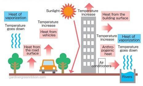
Figure 1: Depiction of the Urban Heat Island Effect in cities
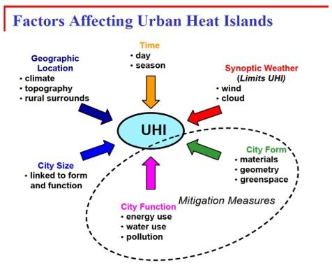
Figure 2: Factors which effect the Urban Heat Islands
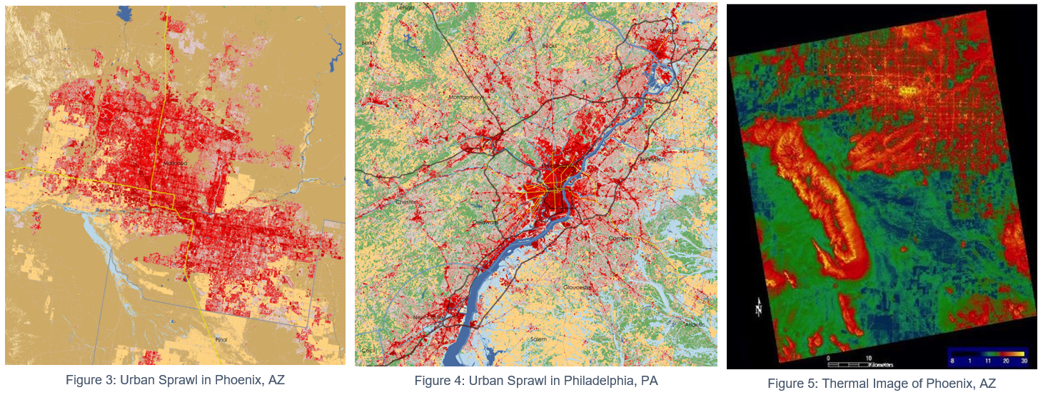
Our scientists will study cities with different urban designs, from skyscrapers to urban farms, to determine how the city design might affect the Urban Heat Island. Urban sprawl occurs when people move out of the city to live in rural areas. As a result, grocery stores, shopping centers and all other types of consumer-based stores moved with them. This creates a very spread-out city (shown in Figure 1).
A smaller urban sprawl is shown in Figure 2, this shows most people staying around the core of the city. In these images, red represents the developed area. Within the red area there are neighborhoods, apartment complexes, shopping malls, grocery stores, schools, tall buildings, etc. The yellow means that it's a rural area, mostly used for agriculture, like growing food
An example of a thermal infrared image of Phoenix is shown in Figure 3. The red indicates warm temperatures on the surface, and green indicates cooler surface temperatures.
What is GIS?
GIS (Geographic Information System) is software that spatially represents data. This means that you can see how things like roads, buildings, or lakes are spread out over an area, like a map. Our scientists will assemble different features of their study cities into data ‘layers’ (shown in the image below) and use these layers to find spatial patterns that might help limit an Urban Heat Island.
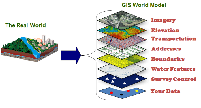
Figure 6: GIS Model (source: Indiana Geographic Information Office)
Want more information on UHIs?
Check out the videos on the UHI effect below to learn more about this phenomenon and how it affects our cities.